I found a blog on the internet by a group who did a round trip in the western USA with a route that includes many interesting and scenic places. This inspired me to plan for and make my first long trip on the motorcycle in the USA.
July 1 2016. Missouri City to Lubbock 520 miles
The route today will take me to Texas 36 which takes me up to Abilene, then along I-20 and finally on US-84 to Lubbock. Texas is a big state and the first day will be a long ride.

The wife and baby got up early to see me off and then I was on my way.
I stopped for a water break at Comanche. When I was a kid you knew about some of the different Indian tribes from TV wild-west shows and the Comanche tribe was one of them. So quite special to stop here for a short while to refuel the body. It’s July in Texas so the temperature is bound to get high and today is no exception.
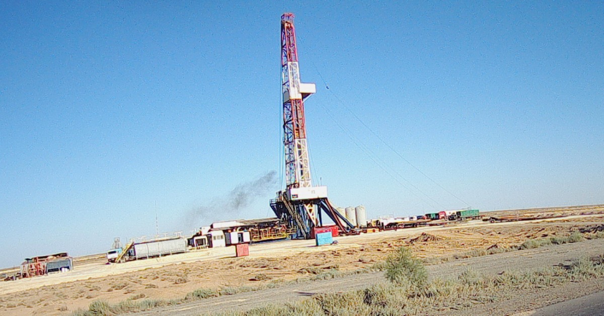
After lunch in Abilene I made it to Lubbock around 5pm, so the first day is completed! It was pretty hard work with temperatures reaching 36C (97F). Also, the scenery in the parts of Texas I traveled through is not the most interesting… On the road from Abilene there are many wind-turbines as well as donkey-head oil pumps so wind above ground and oil below ground.
I had dinner at an Appleby’s close to the hotel. After a nice chicken meal with a Margarita I felt much better but still wondering what I had got myself into. Maybe, I was dehydrated after the long ride, but I didn’t really feel too optimistic about spending another 16 days away from home on my own.
Lubbock to Fort Sumner 273 miles
Early morning setting off after some freshly made waffles with coffee. I slept from 2030 to close to 0600, soo tired after the first day of riding. Well, today was not nearly as far as the first day and with some nice scenery along the way so should be pretty good.
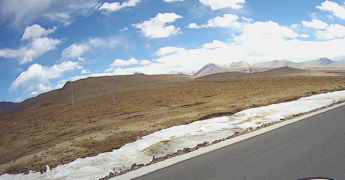
The map shows I will first be traveling north to Palo Duro Canyon state park on I27 and then on to US60 which I will be on for the next few days.

Hotel manager.
The Palo Duro canyon Texas state park is the 2nd biggest canyon in the US, of course, after the Grand Canyon! It’s located in the Texas pan-handle and close to Amarillo. After an early morning easy ride north from Lubbock on I-27 I entered the park. It clearly is a huge canyon 120 miles long and 5-6 miles wide with an average depth of 250m. There is a road from the top leading down to the base and I rode along this. I was getting low on fuel and didn’t want to risk running out so I turned back before getting to the end.


Fort Sumner
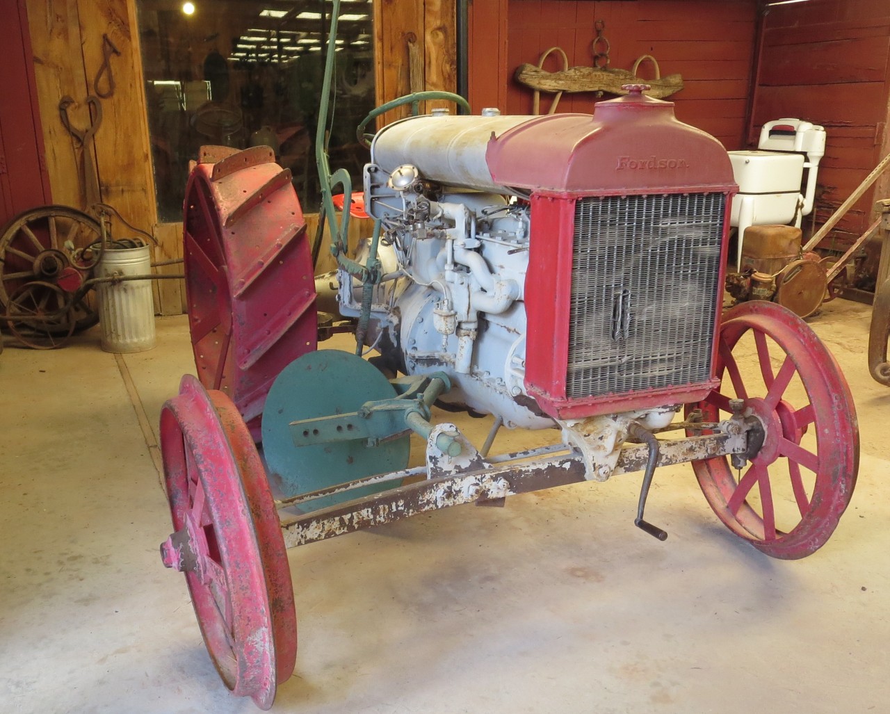
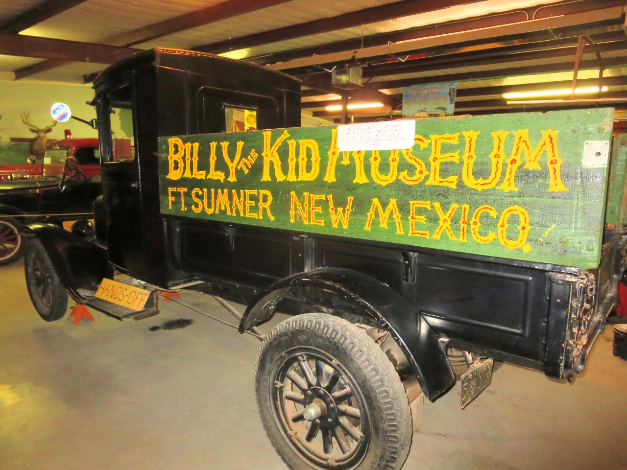
After refueling I set off along US 60 towards the west and Fort Sumner. It’s a straight dual carriage highway and with few cars which made for easy but not very exciting riding and I reached the town early afternoon. Fort Sumner is pretty bleak place in the middle of nowhere. However, it’s the town where Billy the Kid is buried. So, of course, there is a museum to celebrate the outlaw. So I went to the museum – right next door to the motel, and learnt a bit more about the kid. He was only 21 when he died and, maybe, he wasn’t all bad. His father died when he was young and his mother when he was 15 and he started his criminal career soon after. After 6 years of criminal activities he was captured by sheriff Pat Garret and was sentenced to be hanged. He escaped and came to Fort Sumner where he was found and shot by Sheriff Garret.
There was also a collection of old cars, tractors and wagons in the museum so and I snapped some pics of them.
Later on I went to the burial site of the kid a few miles from the town.
I thought I’d find a local restaurant for dinner but couldn’t find anything open so luckily I found a supermarket and bought a microwave dinner. It wasn’t fantastic but eatable…


Well kept or restored 1950’s car. No idea which make or model.


Billy the kid with his gun.
July 3, Fort Sumner to Springerville – 342 miles
I got away early at 0630 , a nice and cool start of the day! Beautiful weather, hardly a cloud in the sky so should be another fantastic day in the saddle!
Stopped here for first break of the day. You could clearly see people had used the plaque for target shooting so it was now unreadable…

Later on I stopped to admire the Karl G. Jansky Very Large Array (VLA) which is a radio astronomy observatory located on the Plains of San Agustin, between the towns of Magdalena and Datil, some 50 miles (80 km) west of Socorro, New Mexico. It comprises 27 25-meter radio telescopes in a Y-shaped array and all the equipment, instrumentation, and computing power to function as an interferometer. Each of the massive telescopes is mounted on double parallel railroad tracks, so the radius and density of the array can be transformed to focus on particular bands of wavelength. Astronomers using the VLA have made key observations of black holes and discovered magnetic filaments and traced complex gas motions at the Milky Way’s center, probed the Universe’s cosmological parameters, and provided new knowledge about the physical mechanisms that produce radio emission.
It is also the setting for scenes in Contact, a 1997 science fiction movie starring Jodi Foster and Matthew McConaughey.


Vaughn, New Mexico.

Before hitting Pie Town I passed by the continental divide so waterways further west will drain into the Pacific.
Pie Town
The name comes from an early bakery that specialized in dried-apple pies and was established in the early 1920s. It is to this day the location of several establishments serving mouth wateringly new baked pies. Of course, I had to have one with a dollop of ice-cream. Very delicious!


Springerville
I stopped here for the day after 330 miles today in pleasant temperatures. The town is called Springerville which is located at an altitude of 2100m and I found a room at Reeds lodge, a rustic kinda place. Because of the 4th of July holidays and the proximity to Phoenix and Tucson, it was not easy to find a room so I had to settle for a smoking room 🙁 however, they ran an ionizer to reduce the smell of smoke and it worked pretty well.
I had dinner at a restaurant which John Wayne with his ranch hands used to frequent in the 60’s. Apparently he owned several ranches in the area.
After the in room chicken microwave yesterday today’s rib-eye tasted exceptionally well. The waitress poured me a very generous glass of red wine so dinner was very good.
Since Arizona decided not to have daylight savings I’m now two hours behind Texas time.
Springerville is at such a high altitude that the temperature is much lower than in the big cities of Tucson and Phoenix and consequently people of those cities low to come here to cool down, that’s why it’s difficult to find a room, especially at extended weekends such as the 4th of July.


Reeds lodge interior.

Very traditional looking diner in Springerville.

Missouri CIty – Lubbock – Fort Sumner to Springerville
Springerville to Payson 231 miles
Had a very early start at 0600 and rode to Ft Apache. The road crossed some high hills and at one stage the elevation was more than 2700m and with a temperature of 10C it felt rather cold.
After an hour or so the road was descending and had some very nice sweeping turns and in the middle of a turn I met a police car, in the mirror I saw him quickly turning around and putting his lights and sirens on and I knew he was coming after me! I stopped before he caught me up in a parking space along the road and sure enough he stopped right behind me. After coming out of his Ford explorer the cop said I was doing 75 in a 55 zone. He turned out to be a nice chap and after checking license and insurance he lowered my speed to less than 65mph and gave me a ticket for wasting energy by going to fast! But no points on my license… He was a great guy and we then had a chat about the area which turned out to be Indian land. So, not fun with a ticket but it could have been a lot worse 🙂
After this I rode a bit slower and soon reached Fort Apache. This used to be a military fort and played an important part in the indian wars in the late 19th century but was converted into a Bureau of Indian Affairs boarding school after its military use ended. I spent a bit of time here trying to picture in my mind indian wars from the many Wild West movies I’ve seen.


Not far from Fort Apache I stopped at the Kinishba ruins. Estimates suggest the buildings were built and occupied from the 12th to 14th centuries as part of the ancient population boom within the Mogollon Rim region and beyond. Centralized in the lush mountains of the Mt. Baldy watershed, the area has been linked to both Mogollon and Anazazi cultures. They were considered part of the western Pueblo complex.
There you go, the benefit of having Wikipedia handy!


Tonto national monument
The Tonto National Monument provides a place to explore and learn about a unique part of America’s heritage. Wikipedia states; “The Salado Phenomena, 700 years ago, blended ideas of neighboring Native American cultures to emerge a unique and vibrant society. Tonto National Monument showcases two Salado-style cliff dwellings. Colorful pottery, woven cotton cloth, and other artifacts tell a story of people living and using resources from the northern Sonoran Desert from 1250 to 1450 CE. ”
To see the cave dwellings required a steep walk and in the 38C temperature I decided I would be happy with a photograph!


It’s a beautiful area with desert like terrain meeting a lake, very picturesque!


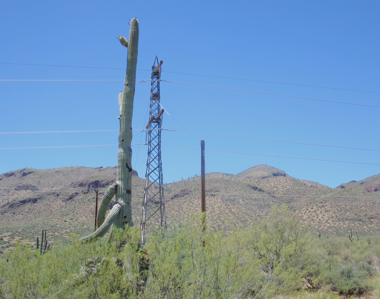
I saw the cactus in the picture along the road, it’s absolutely enormous! It’s a tree looking cactus called the Saguaro and it can grow to 12m height and 150-200 years age! Amazing!
Payson Arizona
I reached Payson late afternoon and checked in to Quality Inn.
The day started with cool temperature of 15C going down to 10C at the summit of 2700m. The trip then gradually came down to lower elevations with increasing temperatures and the reading on the bike showed 40C for some time.
The roads where the best so far on the trip for a bike, quite a few twisties, mainly sweepers but also some sharp corners when riding across the Salt River Canyon which also had some spectacular views, see photos.
Being caught for speeding put a damper on the day but the cop was nice and the fine only $67.50 with no points on the licence, so could have been a lot worse. However, going at 55mph on a good road is not much fun on a motorcycle, particularly if there are some nice long sweepers:-( I was going to ask the cop if I could take a photo of him but thought it might not be apropriate. It seems speed limits in New Mexico and Arizona are lower in general than Texas. I was riding on a minor road leading to the Duro Canyon and the speed-limit was 75mph! OK, that actually seemed too fast for the fairly narrow road…
The Quality inn hotel was very nice with a huge room and s small pool. Had Mexican Fajitas for dinner – also pretty tasty.
Payson to Cameron 236 miles

Today’s route should be exciting going along US 89A to Jerome which is a twisty road going up and down a mountainous area then to the beautiful area at Sedona before going on towards Flagstaff and then west of Grand Canyon to the Cameron trading post.
Stopped for breakfast at Starbucks, latté and an almond croissant. Enjoyed some wonderful riding this morning along US 87 and Arizona 260. A lot of flowing sweepers and no cars!
Stopped in Jerome, an old mining town after first riding along 89a, amazing road with supposedly 127 turns! Almost as good as Stelvio – or maybe not, but very nice. Jerome used to mine copper until the 1950s. In the 20s it had a population of 15000 but after the copper boom was over the population dwindled to some 50 people in the late 50s! Stopped in the bar for a drink.

Red rock formations around Sedona.

Stopped to admire the view at Oak Creek Canyon scenic overlook. I just came up that road – very nice!
Cameron Trading post. West of Grand Canyon
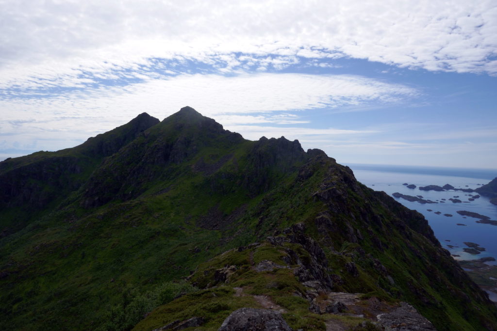
Checked in at Cameron trading post. Seems like a really nice place in the middle of nowhere. The good thing is that it’s only 30 miles east of Grand Canyon. Today saw some great scenery and some great riding. I started early at 0630 on Arizona 260 with many great sweepers and very few cars. The road came up as high as 2100m and then down to 1200m where it joined I-27. After a few miles south on I-27 Arizona 169 led to US89A that went up the pass and then down again to Jerome. It supposedly has 127 turns during a 12 mile stretch. I stopped in Jerome for some refreshments and enjoing the old copper mining town. I then came back on US89A towards Flagstaff and passed through Sedona in the red rock country, very beautiful and dramatic red rock formations. The road followed Oak creek and again climbed through many turns up the side of the creek before eventually leading to Flagstaff. I did not stop there but went straight on to Cameron. The last bit of the road was straight but heavy cross-winds made the riding somewhat hard work. Cameron is in Navajo reservation land and most of the staff at the trading post appear to be Indians. Interesting. I’m staying here for two nights with a round trip to Grand Canyon tomorrow. I’m really looking forward to seeing the magnificent natural wonder again, it’s the third time I see it but it’s something you can come back to again and again.


Grand Canyon
I reached Grand Canyon by 0700 and got the beautiful morning light and a nice cool breeze welcoming me. Coming in from the east there are many vistas where to admire the view with the first one being desert view where there’s also a tower built in an old style. The views are breathtaking but as you go along to see more and more different views you do, perhaps, get saturated? It’s difficult to find a place to have breakfast but finally I found a place. It’s funny – I can see 3 blocks with restrooms but nowhere to eat – what’s the logic in that?


Walked 4 km along the rim to the El Tovar hotel digesting the overwhelming views as I walked along. Will such experiences change your outlook on life? Haha, that’s too deep for me to answer. After another coffee in the hotel I’ll walk to the Bright Angel trail head, the name comes from a cambrian shale which is part of the Grand Canyon section. I did walk to the trail and walked down it for 10 minutes or so and then back up. I was afraid to use too much energy since I had to ride back to the hotel in Cameron which turned out to be 50 miles. Or, maybe I was just lazy? I now felt I’d had enough of GC after spending 6 hours there and decided to go back to the hotel in Cameron.


July 7, 2016. Cameron trading post to Panguitch 230 miles
Standing on the old bridge crossing the Colorado river 100m below. Beautiful bridge and amazing scenery. I got up at 0530 , as usual, and had a proper breakfast before setting off going north on us 89 and then turning on to 89A – this is the road that you take to get to the Grand Canyon north rim. This is the first stop of the day. Being early and high altitude the temperature was in the mid 20C. A very pleasant morning.
Bryce Canyon
Yet another canyon but very different from Grand Canyon. Beautiful orange sandstone that’s eroded to create figure like formations. This place is just incredible! I walked along the rim and went down some way on the Navajo trail, quite a descent (in my mc gear!).
Salt Lake City is famous the world over for being the center of the Mormon church and it was a must visit place on this trip. I’m now in Utah and will be traveling through the state for the next 2-3 days. Along the road I see many beautiful church-like buildings were no expense was spared in their construction. I reached Salt Lake around noon time and found motorcycle parking spaces close to the center of town. After surveying the area I set about looking at the Temple Square which was the original area set aside for the Mormons in the 1840s. The Tabernacle is a rather unusual building that has been praised as an architectural wonder but has also received negative reviews as being ugly and dreadful. For it’s time the roof span of 150×450 ft with no supporting pillars was ahead of it’s time when it was finished in 1867.

Mormon Tabernacle.

Salt Lake Mormon Temple
After lunch in the Nauvoo Cafe housed in the Joseph Smith Memorial building I rode north towards Ogden and the hotel I had booked for the night. However, I got somewhat lost and decided to carry on until the first decent motel along the way. So I ended up in a Comfort Inn outside of the town Logan, if only I had known that in the town itself there were lots of accommodation and then I wouldn’t have had to ride the bike to get to a restaurant. Oh well, no big deal.
Today was not so exciting, I suppose the previous 3-4 days have set my expectations too high. Salt Lake was nice but not hugely so:=( I also felt a bit tired. I hope a good night’s sleep will get me off to a good start tomorrow for the ride to Jackson Wyoming. So far I’ve been in Texas, New Mexico, Arizona and Utah. Tomorrow I’ll briefly touch Idaho before going into Wyoming.
A note about time zones which is kind of confusing. New Mexico and Arizona are in the mountain time zone. However, Arizona decided not to go with daylight saving so they’re 2 hours behind Texas. To complicate matters the Native American reservations decided to go with daylight savings. Utah is on mountain time with daylight savings…
Logan to Jackson Hole Wyoming – 193 miles
Jackson Hole is known for it’s wintertime skiing but it’s also busy during the summer so I needed to get there early to secure lodging for the night. After the usual motel breakfast of hot waffles and weak coffee I got going but I missed the turnoff to the west along US 89 and ended up going along US 91 instead which was due north. It took me some time to figure out I was going the wrong way but when I did I found that road 36 would take me back on the 89 and what a delight the road turned out to be! It went up a mountain pass to 2200m and then down again along twists and contortions making for a beautiful ride on a my Trophy.
Back on 89 I stopped in the town called Afton for a coffee. It boasts it has the largest elk antler arch in the world spanning 4 lanes across the US 89 with 3000 antlers used in its construction and weighing in at 15 tonnes. BTW… “Afton” is a funny name for a swede, in swedish it means evening!

Jackson Hole
Once I arrived in Jackson I managed to get a room at motel 6 at an outrageous price. I changed into “civilian” gear and taking the bus to the center of town for some relaxation. It’s Saturday and a busy day with lots of tourists walking around not doing much apart from being touristy. There are four entrances to the Town Square and there are basking musicians in front of three of them. They must have shot a lot of elk in Wisconsin since there are so many arches built by elk antlers! Very nice though, it must be a lot of work getting them all in place, I wonder if they glue the pieces together?
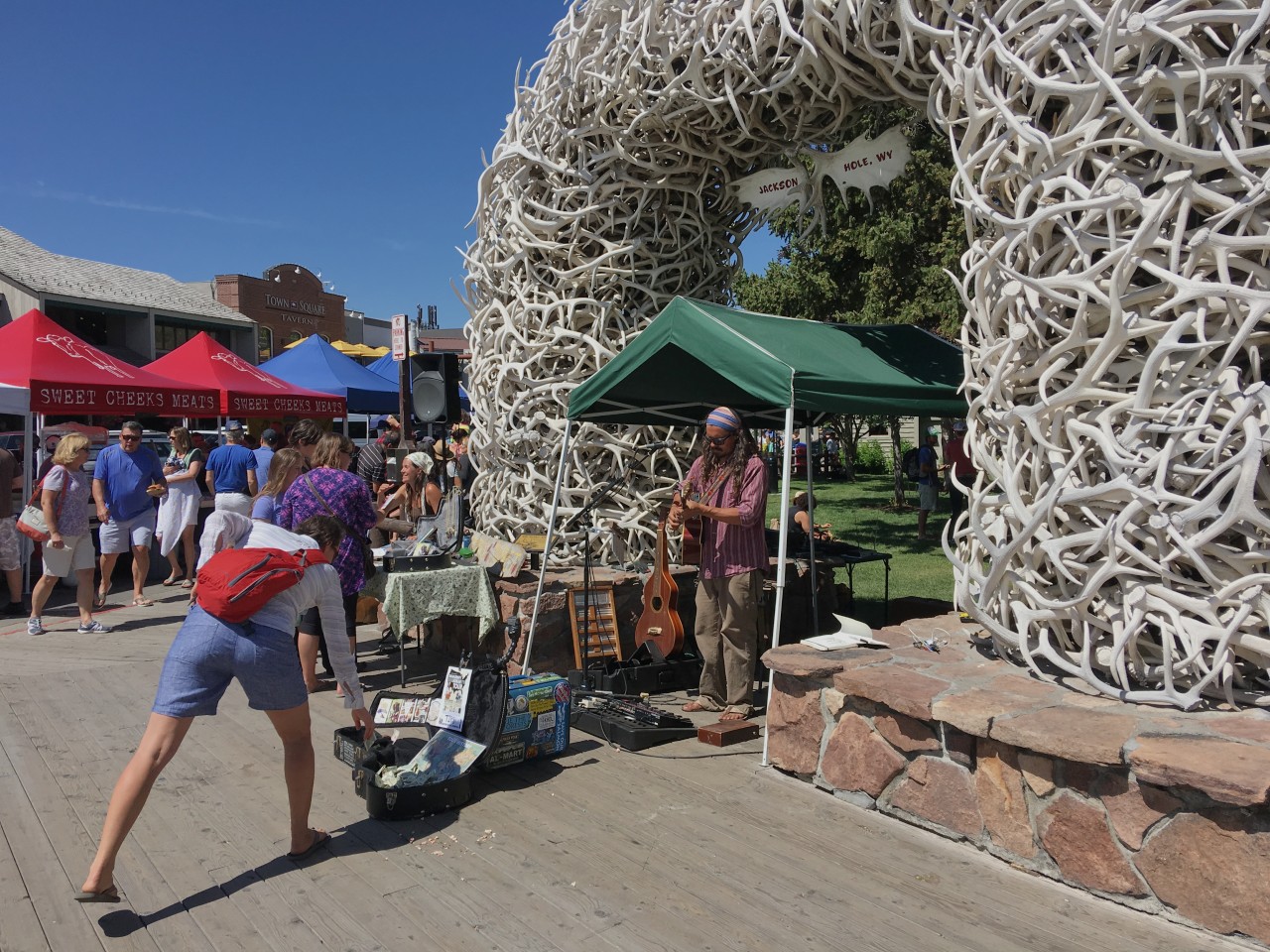
The famed elk antler arches that lead into the town’s lovely, tree-shaded Town Square where locals and visitors come to relax or enjoy special events.

Riding police keeps the order in town and attracts attention from visitors.

Great ski slope close to center of Jackson Hole.
The Jackson ski slope is very close to the center of town and it seems like a good slope. I saw that the lift was going so I strolled down to it and asked the lift guy, he said its 479m elevation change which is really good. I’m sure the skiing there is fantastic! It’s also lit in the winter meaning you can ski to late evening.

Cameron, AZ to Jackson Hole, WY
Jackson Hole through Yellowstone National Park to Gardiner, Montana – 190 miles
It’s cold when I start and I wish I had heated grips on the bike. The weather is clear when and I get really good views of the Tetons just to the west of me. I stop at the, apparently, most photographed barn in the US to get some photos of the mountains with the barn in the foreground. The sky is darkening to the north and not boding well for my passing through the Yellowstone National Park.


As I pass by Jackson lake the sky is looking really dark and it starts to rain and as I get to the Yellowstone entrance the rain turns into hail and it gets really cold. I stop to put on the cold weather gear I brought, which is not enough, when I set off from home I had no idea that it would get this cold. With the rain gear on I start the trip through Yellowstone, brr. After a couple of hours in these conditions I finally reached Ye old faithful Inn and stop for breakfast and to warm and dry up. Food is really nice and I start to thaw up pretty well.
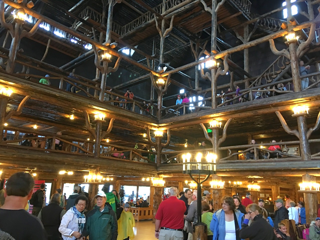
Ye old faithful hotel.
s


Gardiner
It was a relief to arrive at the “Yellowstone River Motel” in Gardiner. The day started out beautifully with grand views of the Grand Teton mountains but just as I was entering Yellowstone national park it started hailing and with the low temperature of 7C I felt pretty miserable on the motorcycle ????.
With the road being white in places from the hail I tiptoed my way, very afraid of slipping. My hands were getting numb from the wetness and the cold plus me being tense… This does not make for very pleasurable riding and you also loose the feeling for the road when you need it most on wet and pretty rough asphalt roads. But I managed to get to Old Faithful Inn to warm up and as I was having breakfast the rain stopped.
Gardiner is located right at the northern entrance to Yellowstone and is a small town living off people stopping by before entering the park I presume. Not sure what they do in the winter with so many fewer tourists?
I found a laundromat and washed my clothes, good, that means I don’t need to wash em by hand????
There’s a grill place so I had a nice rib-eye washed down with a glass of Malbec which got me in a really good mood.
The river in the picture is the Yellowstone river and is just to the back of the door to my room.
July 11, 2016 Gardiner to Gillette (400 miles)
Today is a pure transport day and there are not a lot of sights along the way. I stopped for lunch at a McDonald’s close to the town of Sheridan. I was sharing the table with a local guy and had to listen to him talking incessantly about his family history and how he spent 35k on his research including dna tests. Yawn yawn????. Of course, he also told me the country would be safer if people had more guns and/or fierce dogs to keep the bad guys away. He was voting for Trump, he also told me ???????? If nothing else it gave me company and some entertainment for lunch.
Gillette
Checked in to Day’s Inn Gillette Wyoming after a 400 mile ride today. Most of the ride was in light rain with strong cross-winds and a temperature around 11C making for a somewhat hard ride. The last couple of hours, after lunch, the weather got better with no rain and 20C allowing me to take the rain gear off.
The speed limits in Montana and and Wyoming are at 80 and 75mph so I could make fairly rapid progress. With the strong cross-winds it was dodgy going even that fast. With water on the road the big trucks create an enormous amount of wet mist and when passing them it’s like going into a fountain of mist with very limited visibility.
I met a guy on an old Ducati Monster at a rest stop who was on his way from Seattle to Mount Rushmore. With little protection from the elements and cramped riding position on that bike he must have suffered. He was also camping… Well, he was young.

Tomorrow I’m first going to Devils tower which is an laccolithic butte composed of igneous rock in the Bear Lodge Mountains near Hulett and Sundance in Crook County, northeastern Wyoming. It looks quite spectacular on the pictures I’ve seen.
If I get up early and the weather is cooperating I should be able to see Mount Rushmore tomorrow as well.
Gillette, WY, to Keystone,SD, taking in Devil’s tower and Mount Rushmore
Devil’s tower
This is an amazing natural “monument”. I’m walking the trail around the tower among Ponderosa pines and I’m here early so hardly any people. An incredibly peaceful experience in awe of what nature can accomplish.


Steven Spielberg fans are likely familiar with Devils Tower, even if they don’t know it by name. The dramatic butte—which towers 1267 feet above the plains of northeastern Wyoming and the Belle Fourche River—was famously featured in 1977’s Close Encounters of the Third Kind, culminating in a scene in which an alien mothership descended upon the rock formation. Interestingly, it was also the first national monument in the US.
After a couple of hours at Devil’s tower I continued towards Mont Rushmore and stopped by the Pactola Dam on 385. As I was admiring the views a motorcycle trike (3 wheels) stopped at the same place. It was towing a dog trailer with 2 dogs in it! I had a chat with the owners and one of the dogs was not so happy being in the trailer. I can imagine the trailer sways quite a lot so I’m not surprised the dog wasn’t happy.
Ok, finally made it to Mount Rushmore. Ever since I saw Hitchkock’s North by Northwest (one of my favorite movies) I wanted to see the monument. And finally here I am! I’m not sure I’m as impressed as I thought I would be, but the scale of the Monument is amazing. I walked the presidents trail that takes you much closer to the carvings and you can get some good close ups of the faces with a zoom camera. So who are the presidents? Well, from the left its George Washington, Thomas Jefferson, Teddy Roosevelt and Abraham Lincoln. I guess all Americans know this from an early age? Constructed between 1927 and 1941 it was not completed to its original design but the work stopped due to lack of funding. It seems they did not need to complete it – there are two million visitors every year!
Mount Rushmore
Keystone to Salina (610 miles)
Salina, KS
Checked in at Days Inn. Supposedly I’ll get a free night now that I stayed more than two nights but they probably make it so complicated that it’s not worth the effort?
Did 620 miles today and still feel pretty good. Guess mind and body is more used to sitting on a bike for about 9 hours..
The day started out pretty cold at 10C but gradually warmed up as I got further south and lower elevation to end up at 34C. Mainly going on non-interstates and single carriageway, but they are in good condition with little traffic so my average speed today was 68 mph (if you believe the statistics produced by the bike).
Today I’ve ridden through South Dakota, Nebraska and now Kansas. Seems like they are all big farming states – riding past huge fields of cereal and corn. They’re harvesting the cereal fields with huge combine harvesters as I ride past.
I had a salad dinner at the nearby Mexican restaurant, it was nice with a cold beer after today’s time in the saddle! When on your own it’s nice to sit at the bar where you can chat to the bar staff and other people seated there. I talked to the bar girl and she said you pronounce Salina as it rimes with “saliva”. Strange pronunciation…
Tomorrow towards Oklahoma City, Dallas and possibly Houston… Home trip going quicker than I originally thought.
July 15, 2016 – Salina to Houston (719 miles)
Stopped at a scenic outlook and came across a wing for a wind turbine. It looked massive but the guys transporting it said it was a baby, maybe around 40m. The biggest ones in Europe are 85 m long they told me.
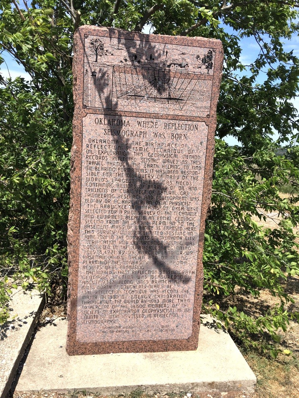
Paoli, OK

At the same spot there was a stone commemorating the birth of reflection seismic! J Karcher did the first experiments in the area in 1921. What a coincidence! I’ve spent my entire career on reflection seismic and haphazardly coming across this memorial stone is quite amazing!
Riesel, TX
More fuel and some junk food. Only 180 or so miles to home…its been very hot with temperatures as high as 40c. Coming through Fort Worth was a big pain with a lot of road construction and it felt very uncomfortable going very slowly as the traffic was crawling. You also ride between huge trucks and it doesn’t feel so safe. Nevertheless, I got through it, but it delayed me by an hour! Once I cleared the road works and later an accident that stopped the flow for 10 mins or so I made rapid progress to Waco where I left I-35 and joined Tx 6. I should reach home before it gets dark.????
Missouri City
Home sweet home!
In total I did 4627 miles using 97 gallons of fuel. I rode the bike for 82 hours. The longest day in the saddle was the last day when I did 716 miles. I saw a lot of beautiful scenery on the trip starting with the Duro Canyon in the northern part of Texas and ending with the mammoth carvings of the four presidents at Mount Rushmore. An absolutely amazing trip! The map shows today’s ride – a bit over 700 miles. The bike was absolutely problem free, it’s a great bike when you’re on the open road but heavy when manouvering at slow speeds and when parking. The panniers are 7 kg when empty so when full they’re probably around 15 kg adding 30kg. The Michelin pilot road 4 are really good with the photo showing the rear tyre after 4700 miles. The tread depth is still between 4 and 5 mm – when new it’s around 6mm!


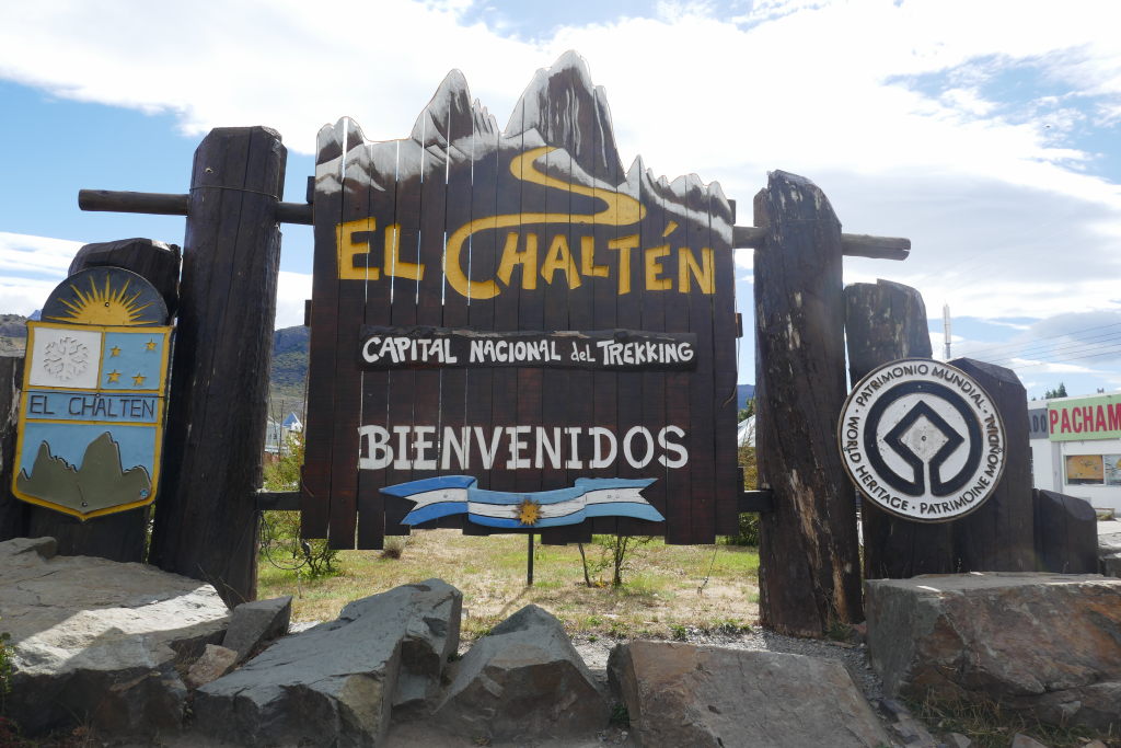


 As I walk around this and other towns I can’t help but notice streets and areas with the name “O’Higgins”. This doesn’t sound very Chilean or even Spanish so who was this man? It turns out that he is considered the father of independent Chile. He had Irish and Spanish ancestry and he was instrumental in freeing Chile from Spain in the early 1800s.


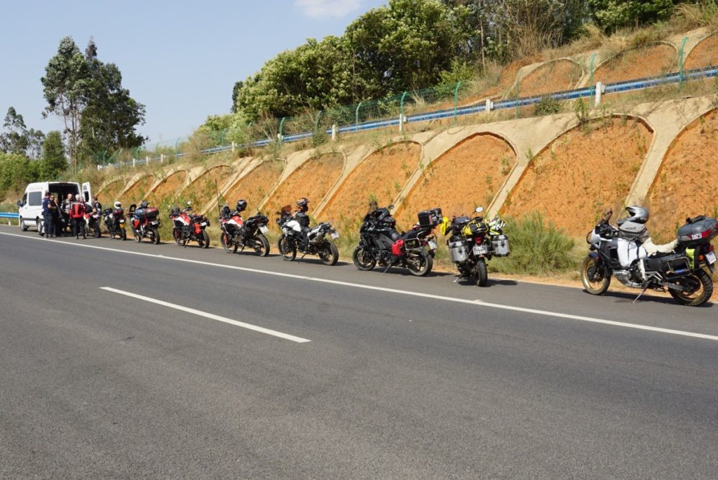
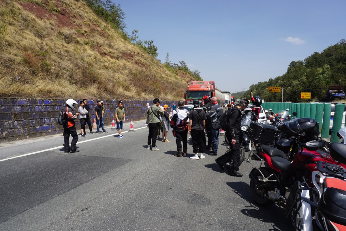
 Stopped for a long time for road works.